What counts as a Buckhead neighborhood
Buckhead has no legal boundary of its own. It is a district of the City of Atlanta, and the City organizes its official neighborhoods into lettered Neighborhood Planning Units. The three NPUs that make up Buckhead are A, B and C.
The City of Atlanta is divided into 25 Neighborhood Planning Units (NPUs), lettered A through Z (there is no U). Each NPU groups several official neighborhoods. (City of Atlanta, checked 2026-10-19)
These lists come from the City. Neighborhood names on a listing, a sign or a subdivision entrance do not always match them, so use the City’s names when you look up a property or follow a zoning case. The City keeps current lists and contacts on its NPU contacts page.
NPU A
NPU A includes 11 official City of Atlanta neighborhoods: Chastain Park, Kingswood, Margaret Mitchell, Mt. Paran Parkway, Mt. Paran/Northside, Paces, Pleasant Hill, Randall Mill, Tuxedo Park, West Paces Ferry/Northside and Whitewater Creek. (City of Atlanta, checked 2026-10-19)
NPU B
NPU B includes 16 official neighborhoods: Brookhaven, Buckhead Forest, Buckhead Heights, Buckhead Village, East Chastain Park, Garden Hills, Lenox, Lindbergh/Morosgo, North Buckhead, Peachtree Heights East, Peachtree Heights West, Peachtree Hills, Peachtree Park, Pine Hills, Ridgedale Park and South Tuxedo Park. (City of Atlanta, checked 2026-10-19)
NPU C
NPU C includes 21 official neighborhoods: Arden/Habersham, Argonne Forest, Brandon, Castlewood, Channing Valley, Collier Hills, Collier Hills North, Colonial Homes, Cross Creek, Fernleaf, Hanover West, Memorial Park, Peachtree Battle Alliance, Ridgewood Heights, Springlake, Wesley Battle, Westminster/Milmar, Westover Plantation, Wildwood, Woodfield and Wyngate. (City of Atlanta, checked 2026-10-19)
Marketed as Buckhead, but not in its NPUs
Several neighborhoods just south and east of Buckhead are often advertised under the Buckhead name. By the City’s own lists they belong to other planning units. That matters when you follow a zoning case, go to an NPU meeting, or compare listings that use the Buckhead name loosely.
Not in NPU A, B or C
- Brookwood Hills, Brookwood and Ardmore, often marketed as south Buckhead, are officially in NPU E (with Midtown, Ansley Park and Atlantic Station), not NPU A, B or C. City of Atlanta, checked 2026-10-19
- Piedmont Heights and Morningside/Lenox Park are in NPU F, not a Buckhead NPU. ('Lenox' in NPU B and 'Morningside/Lenox Park' in NPU F are different neighborhoods.) City of Atlanta, checked 2026-10-19
One more name to watch. NPU B includes a City neighborhood called Brookhaven, and it is a different place from the separate City of Brookhaven.
The City of Atlanta has an official neighborhood named 'Brookhaven' in NPU B. It is a different place from the separate City of Brookhaven, which is outside Atlanta. (City of Atlanta GIS, checked 2026-10-19)
Finding a home’s official neighborhood
Listings often use a subdivision name or a broad label like North Buckhead. To find the City’s name for the neighborhood a home sits in, and its NPU, look the address up on the City’s maps or ask the NPU through the contacts page above. Knowing the NPU tells you where zoning and variance requests near that home will be discussed, and the council district tells you who represents it at City Hall.
Atlanta City Council districts covering the Buckhead NPUs: NPU A is in District 8; NPU B spans Districts 6, 7 and 8; NPU C spans Districts 8 and 9. (City of Atlanta, checked 2026-10-19)
Start with the parcel record on Fulton County’s qPublic parcel search to confirm the home is in the City of Atlanta at all. A Buckhead neighborhood name on a listing does not settle that.
Seven buyer areas, side by side
The official neighborhoods are too many to compare one by one when you are deciding where to look, so this guide groups them into seven buyer areas. Each row below is built only from our sourced research on that area. Where we found nothing, the cell says so, and the area guide tells you who can answer for a specific address.
| Area | Planning unit | Housing | Rail on foot | Places nearby |
|---|---|---|---|---|
| Peachtree Road corridor | NPU B | Mostly condos in mid- and high-rise buildings; house streets sit just off the corridor | Buckhead (Red Line) and Lenox (Gold Line) stations; change at Lindbergh to ride between them | Buckhead Village District, Lenox Square, Phipps Plaza |
| Tuxedo Park and West Paces Ferry | Mostly NPU A; South Tuxedo Park is NPU B | No area-level source; check each listing | Car-dependent; 2.5 mi or more to a station | Governor’s Mansion, Atlanta History Center |
| Chastain Park and North Buckhead | NPU A and NPU B | No area-level source; check each listing | No rail nearby; 2.5 mi or more to a station | Chastain Park, Blue Heron Nature Preserve |
| Garden Hills and Peachtree Park | NPU B | Mixed: its ZIP area has older houses alongside large buildings | Lindbergh Center about 1.1 mi from Garden Hills Park | Garden Hills Park, Christ the King School |
| South Buckhead along Peachtree Creek | NPU C and NPU B | No area-level source; check each listing | Lindbergh Center is the nearest station; check the walk for your street | Atlanta Memorial Park, Bitsy Grant Tennis Center, Bobby Jones Golf Course |
| Paces, Mount Paran and Northside | NPU A | Mostly detached houses in the 30327 ZIP area, which also covers part of Sandy Springs | No practical rail access; 2.5 mi or more to a station | Several private school campuses |
| Lindbergh | NPU B | No area-level source; judge each building or street | Lindbergh Center about 0.2 mi; Red and Gold Lines | Lindbergh Center station |
Sources for the table
- Estimated walking routes on the OpenStreetMap foot network: Lindbergh Center station is about 0.2 mi from the Lindbergh area point and about 1.1 mi from Garden Hills Park. Buckhead station is about 1.0 mi from the Buckhead Village point. The Tuxedo Road, Chastain Park and Mount Paran points are each 2.5 mi or more on foot from the nearest MARTA rail station. OpenStreetMap routing (OSRM), checked 2026-10-19
- North of Lindbergh Center the two lines split. The Red Line (toward North Springs) serves Buckhead Station and then Medical Center. The Gold Line (toward Doraville) serves Lenox and then Brookhaven/Oglethorpe. To ride between Buckhead Station and Lenox Station, you change trains at Lindbergh. MARTA, checked 2026-10-19
- The 2020-2024 ACS shows very different housing from one ZIP area to the next. In ZCTA 30326 (the Lenox/Phipps area), 92.2% of units are in buildings of 20+ units and 1.5% are detached houses. ZCTA 30327 (northwest Buckhead plus part of Sandy Springs) is 61.2% detached houses, and 78.1% of its occupied homes are owner-occupied. ZCTA 30305 is 25.7% detached houses and 60.2% units in 20+ unit buildings. ZCTA 30342 is 35.8% detached and 33.4% in 20+ unit buildings. U.S. Census Bureau, checked 2026-10-19
- OpenStreetMap gives Lenox Square's address as 3393 Peachtree Road NE (30326) and Phipps Plaza's as 3500 Peachtree Road NE (30326). The Census Geocoder places both points in the City of Atlanta, Fulton County. OpenStreetMap, checked 2026-10-19
Where they sit
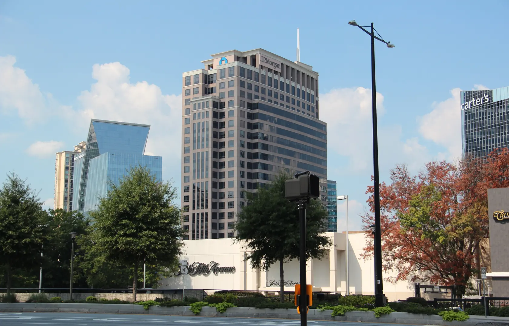
- Peachtree corridor — condos and towers from Buckhead Village to Lenox and Phipps
- Tuxedo Park — residential streets around Tuxedo Road and West Paces Ferry
- Chastain Park — around the 268-acre park, near the Sandy Springs line
- Garden Hills — in-town streets south-east of Buckhead Village
- South Buckhead — along Peachtree Creek, closest to Midtown
- Northwest Buckhead — northwest Buckhead, mostly single-family
- Lindbergh — the Red and Gold Line transfer station
Matching an area to what you need
- A condo with rail nearby: the Peachtree Road corridor or Lindbergh, with the building documents read early. See the condo buyer’s guide.
- A house on a quiet residential street: Tuxedo Park and West Paces Ferry or Paces, Mount Paran and Northside, with the parcel and tree rules checked first.
- Close to a big park: Chastain Park and North Buckhead or South Buckhead along Peachtree Creek, with the flood map checked for creekside lots.
- Older in-town streets near the Village: Garden Hills and Peachtree Park.
What we do not compare
There is no column for price, school quality or who lives where. Prices belong to the live listings. School assignment comes only from the APS School Zone Locator, one address at a time; see Buckhead school zones. We describe places, rules and transit, not people.
Questions buyers ask
Which neighborhoods are officially in Buckhead’s planning units?
Buckhead’s official neighborhoods sit in the City’s Neighborhood Planning Units A, B and C. NPU A has 11 neighborhoods, NPU B has 16 and NPU C has 21.
Source: City of Atlanta
Is Brookwood Hills in Buckhead?
Not officially. Brookwood Hills, Brookwood and Ardmore are often marketed as south Buckhead, but the City places them in NPU E with Midtown, not in NPU A, B or C.
Source: City of Atlanta
Next step
Let the area finder score the seven against your answers, or check whether a specific home is inside the City with our guide to Buckhead addresses and city limits. When one area stands out, open its guide and browse current listings.
Rules, rates and maps change. Every rule on this page links to the office that sets it; confirm with that office before you rely on it.